Enog Geographic Information Technology

(Centre for Integrated Built-Environmental Consultancy & Research)

Geoinformatics (GIS & Remote Sensing Mapping) Services

We deploy Geo-Information Technologies in geo-spatial big-data analysis and produce thematic and general-purpose maps for every economic sector. We integrate our research innovation into our geo-spatial consultancy at all levels, including basic mapping to advanced geo-spatial analyses and modelling to provide answers to geographic questions in every economic sector.

Main Services

Geospatial Data Acquisition

    • Satellite imagery procurement,
    • Aerial surveys and drone mapping,
    • Capturing 3D terrain data and generating elevation models.

Remote Sensing Analysis

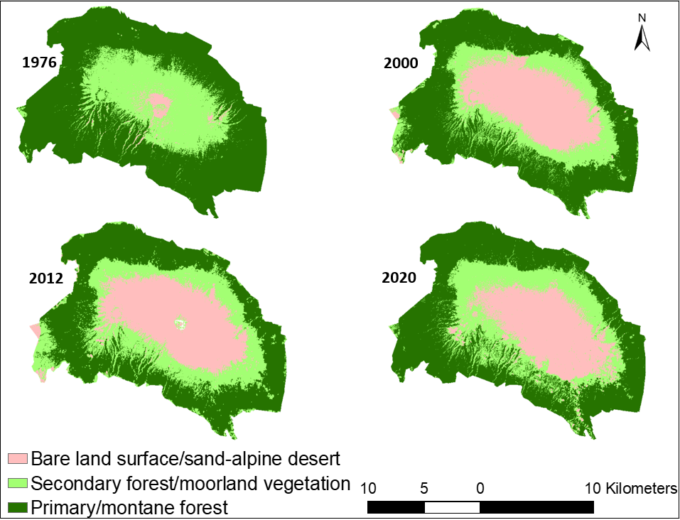
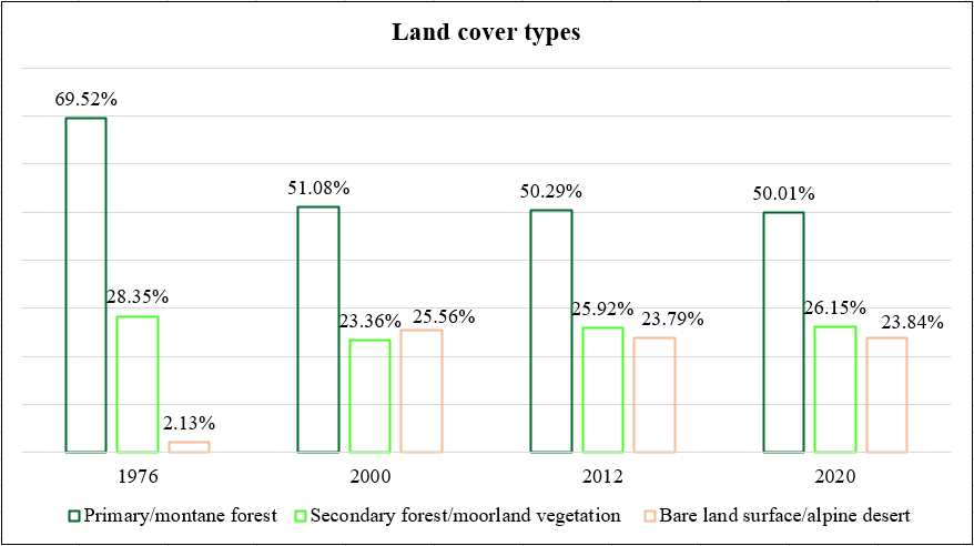
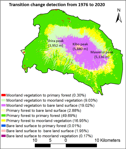
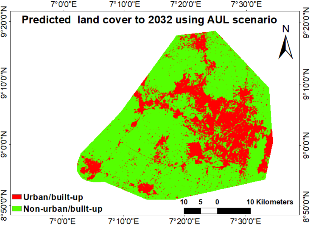
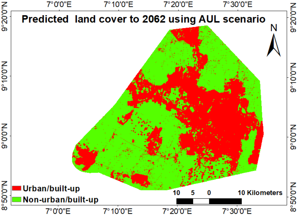
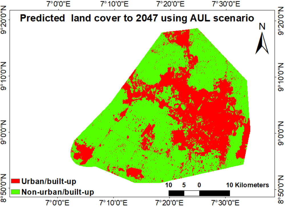
      • Change Detection: Monitoring land use changes, deforestation, urban sprawl, etc.
      • Vegetation and Crop Health Monitoring.

GIS Mapping and Analysis

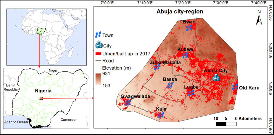
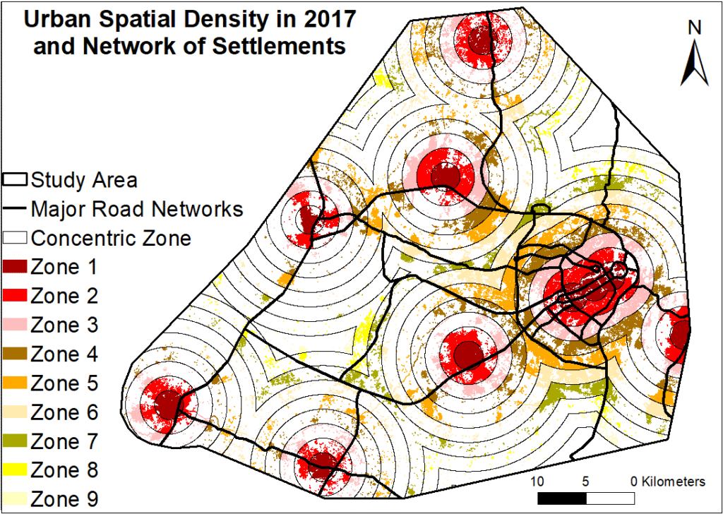
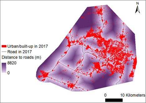
    • Thematic map production: creating land use, zoning, population density, infrastructure maps, etc.
    • Spatial Analysis: buffering, overlay analysis, proximity analysis, suitability modeling.
    • 3D Modeling and Terrain Analysis: Using digital elevation models (DEM) for slope, aspect, and visibility analysis.

Custom Application Development

Environmental and Resource Management

    • Environmental Impact Assessments (EIA): Using geospatial data to model and assess environmental risks.
    • Natural Resource Mapping: Forests, minerals, water resources.
    • Climate and Disaster Risk Analysis: Flood modeling, wildfire risk, erosion prediction.
  •  
  • Urban and Regional Planning

      • Urban Sprawl Monitoring: Analyzing growth patterns and infrastructure needs.
      • Infrastructure Planning: Site selection for roads, utilities, or public services.
      • Land Use Planning and Zoning Support.

Training and Capacity Building

    • Workshops and Courses: On GIS and Remote Sensing software (Python, ArcGIS, QGIS) and spatial analysis techniques.

Decision Support Services

    • Geospatial Intelligence for Policy Making: Supporting governments or NGOs with data-driven decisions.
    • Scenario Modeling: Simulating outcomes for land development or conservation efforts.
Scroll to Top