(Centre for Integrated Built-Environmental Consultancy & Research)
Site, Layout, and Urban Planning & Design
Our Town Planners provide integrated services aimed at the efficient, sustainable, and aesthetic development of land and urban environments. These services are critical for guiding land use, infrastructure, public space design, and the overall spatial organization of cities, towns, and developments. Through urban modelling, our Town Planners produce modern urban designs using various neighbourhood concepts that promote urban green infrastructure and environmental sustainability. Also, our Town Planners are academically and professionally equipped to develop new master plans or follow existing master plans at the local/urban and regional scales. In so doing, socio-cultural, economic, and environmental issues are mandatory considerations at all levels of our planning projects, including site, layout, and urban planning & design. Furthermore, our Town Planners approve site plans for architectural/building designs.
Main Services
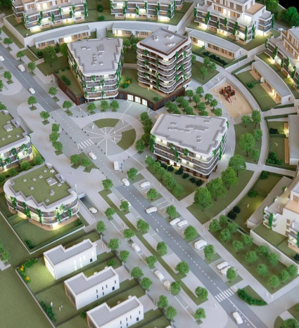
Site Planning and Layout Design
Site Feasibility Studies: Assessing topography, soil conditions, access, and utilities to determine development potential.
Conceptual Site Layouts: Designing spatial arrangements for buildings, roads, open spaces, and infrastructure.
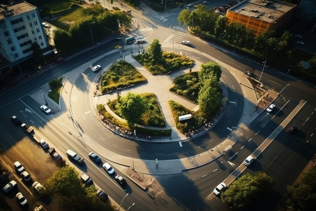
Masterplanning: Comprehensive plans for large-scale developments such as residential estates, industrial parks, or mixed-use zones.
Subdivision Planning: Creating plots or lots for residential, commercial, or institutional purposes.
Urban and Regional Planning
Land Use Planning: Developing zoning proposals and land use maps to guide orderly development.
Urban Growth and Redevelopment Planning: Planning for new urban areas, regeneration of inner cities, or upgrading informal settlements.
Regional Development Planning: Coordinating development strategies across towns, cities, and rural areas.
Urban Design Services
Streetscape and Public Realm Design: Designing attractive, functional public spaces including sidewalks, plazas, and street furniture.
Architectural and Massing Studies: Determining building forms, heights, and densities to ensure visual coherence and human scale.
Urban Aesthetics and Character Guidelines: Preserving cultural identity while guiding new development.
Infrastructure and Transportation Planning
Road Network and Circulation Planning: Designing efficient street hierarchies and vehicle/pedestrian flows.
Public Transport Integration: Planning transit-oriented developments (TOD) and multimodal connections.
Utility and Services Layouts: Planning for drainage, water supply, electricity, and waste management.
Environmental and Sustainability Planning
Green Infrastructure Planning: Incorporating parks, green corridors, and ecosystem services into urban areas.
Climate-Responsive Design: Planning for energy efficiency, flood resilience, and heat mitigation.
Environmental Site Assessments: Evaluating ecological constraints and opportunities for sustainable development.
Community and Stakeholder Engagement
Participatory Planning Processes: Conducting workshops, surveys, and charrettes to involve local communities in the planning process.
Stakeholder Coordination: Liaising with developers, municipalities, NGOs, and utility providers.
Policy, Regulatory, and Approval Support
Preparation of Planning Proposals and Reports: Creating documents needed for zoning amendments, development approvals, or permits.
Compliance with Planning and Building Regulations: Ensuring projects meet local, regional, and national planning frameworks.